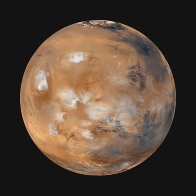
Mars is the fourth planet from the Sun. It is seventh in terms of size and mass. You can spot it in the night sky. It is a periodic reddish object. The symbol for Mars is ♂.
People call it the Red Planet. They associate it with war. The name comes from the Roman god of war. Babylonian astronomers knew this 3000 years ago. They called it Nergal. It is the god of death and plague. Mars has two moons. One of them is Phobos. This means “fear” in Greek. The other is Deimos. It means “Terror”. They were the sons of Ares and Aphrodite.
The numbers behind the red planet
Mars is more than just a story. This is data. The planet’s orbit is far from Earth. The average distance from the Sun is 227,943,824 kilometers. This is 1.5 astronomical units (AU). Its orbit is not a perfect circle. Eccentricity is 0.093. The ecliptic inclination is 1.85 degrees.
A year on Mars is a long time. It takes 686.98 Earth days to orbit the Sun. When Mars is opposite the Sun in our sky, it shines brightly. The apparent magnitude is -2.01. The synodic period is 779.94 Earth days. This is the time it takes for a planet to return to the same position in the sky relative to the Sun as seen from Earth. The mean orbital velocity is 24.1 km/s.
This planet is smaller than Earth. The radius of the equator is 3,396.2 kilometers. The radius of the North Pole is 3,376.2 kilometers. The south polar radius is 3,382.6 kilometers. The area is 1.44 × 10^8 km^2. The mass is 6.417×10^23kg. The average density is 3.93 g/cm^3.
Gravity is weaker there. The average surface mass is 371 cm/s^2. The escape velocity is 5.03 km/s. A day on Mars is roughly the same as a day on Earth. The rotation period is 24 hours, 37 minutes and 22.663 seconds. The average solar day (sol) is 24 hours, 39 minutes and 36 seconds.
The equator is tilted. The inclination angle to the orbit is 25.2 degrees. The temperature is very cold. The average surface temperature is 210 K, or -82 °F or -63 °C. The pressure is light. The typical surface pressure is 0.006 bar. Two satellites are known.
Why Mars is important to astronomers
Mars is interesting for reasons other than its bloody appearance. It is the second closest planet to earth. Venus is closer. Mars is usually easy to spot. Its orbit is outside Earth’s. This planet is the only planet with a solid surface and atmospheric phenomena visible through a telescope on Earth.
Since the 1960s, centuries of research by Earth observers and spacecraft have revealed similarities. Mars is similar to Earth in many ways. There are clouds. It has winds. There are about 24 hours in a day. There are seasonal weather patterns. There are polar ice caps. It has volcanoes. It has canyons.
There are indications that Mars was more Earth-like billions of years ago. The atmosphere there is denser. It was warmer. It has a lot of water. Rivers flowed. Lakes existed. Flood channels carved the land. Maybe the ocean covers some of it.
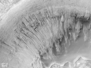
From all indications, Mars is now a barren, frozen desert. But the pictures tell a different story. Dark streaks appears on the crater’s slope. This happens in spring and summer on Mars. This suggests that small amounts of water may flow seasonally.
The InSight lander found something even deeper. The crust 11.5 to 20 kilometers below the surface is saturated with water. This is important. Life as we understand it cannot exist without water. If microscopic life forms originated on Mars, they may have survived in these hidden aquatic environments.
Search for ancient microorganisms
Scientists have been looking for evidence of life for a long time. In 1996, a team of researchers reported evidence of ancient microbial life. They found it in a Martian meteorite. Most researchers dispute this explanation.
NASA has some new announcements for 2025. The Perseverance rover found two minerals. vivianite and greigite. On Earth, these minerals are formed in the presence of microorganisms.
Does this mean there is life on Mars? NASA says it cannot rule out the possibility that life formed these minerals. But we can’t confirm that either. The samples must be brought back to Earth. Perseverance’s instruments were unable to perform the necessary in-depth analysis.
Since the end of the 19th century, Mars has been the most hospitable place in the solar system apart from Earth. This also applies to indigenous life. It applies to human exploration and habitation. There was a lot of speculation at the time. People talk about the canals of Mars. These are complex systems of long, straight surface lines. Few astronomers claim to have seen them.
They believe they were created by intelligent beings. Seasonal changes also confirm this. The expansion and retreat of vegetation explains these changes. This adds to the evidence of biological activity.
The canals were illusory. Seasonal changes are geological. Not biological. However, scientific and societal interest has not subsided yet.
Mars in culture and imagination
Mars has a special place in pop culture. It inspired generations of writers. H. G. Wells wrote during the heyday of the Mars Canals. Edgar Rice Burroughs followed. Ray Bradbury wrote it in the 1950s. Kim Stanley Robinson wrote in the 1990s.
Mars is a central theme in radio, television and movies. Orson Welles created a radio drama based on H.G. Wells’ novel War of the Worlds. This program was broadcast on October 30, 1938. Thousands of listeners believed that beings from Mars was invading Earth. It’s notorious.
The mysteries of the planet still exist. Many real mysteries remain. They promote scientific research. They stimulate the human imagination. This situation continues to this day.
Understanding Mars’ Orbital Mechanics
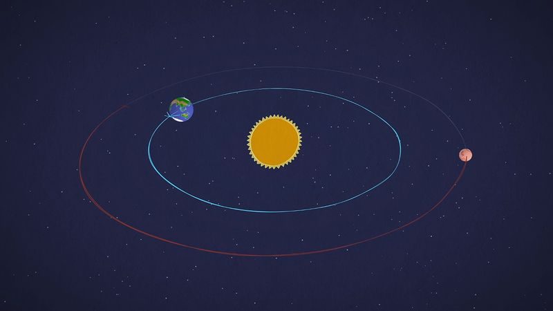
Mars is the fourth planet from the Sun. It travels at a mean distance of 228 million kilometers. That’s about 140 million miles. For comparison, this is about 1.5 times the distance from the star to Earth. The track is not a perfect circle. It is long and thin. This shape means that the distance between Mars and the Sun is constantly changing. At its closest point, the Red Planet is only 206.6 million kilometers away. At its farthest, it drifts to 249.2 million kilometers.
A year on Mars is about twice as long as on Earth. It takes 687 Earth days to orbit the Sun. Distance from Earth varies just as wildly. At the closest approach, the gap shrinks to less than 56 million kilometers. If the planets are on opposite sides of the solar system, their distance can be almost 400 million kilometers.
Why Opposition Matters for Observation
Mars is most easily visible when the sun and the planet are in opposite directions in the sky. This event is known as opposition. During this window, Mars is visible high in the sky. You also get a fully lighted face. The geometry is simple but effective.
Successive oppositions happen about every 26 months. However, not all oppositions are created equal. These events can occur at different points in Mars’ orbit. This timing changes everything for observers on Earth.
Observing conditions are best when Mars is closest to the Sun in its orbit. Since the orbit is elliptical, this brings the planet closer to Earth. As a result, Mars appears brightest and largest. These close oppositions are rare. They occur approximately every 15 years.
“Close oppositions occur roughly every 15 years.”
If you’re going to follow the red planet, timing is everything. When orbital mechanics work in your favor, You want to catch it The absence of a 15-year period means that there is a dark, small disc in the night sky. The science of track mechanics determines when you get the best views.
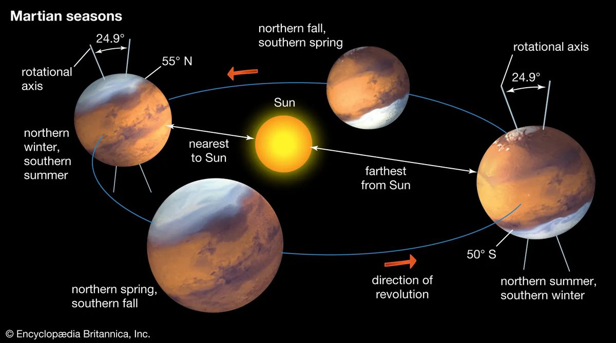
Mars makes one revolution in 24 hours and 37 minutes. It’s a bit longer than our own day. The planet’s axis is tilted about 25 degrees to the plane of its orbit. This tilt creates the seasons. A year on Mars lasts 668.6 solar days, which we call sols.
The orbit is elliptical. This changes the seasons. Southern summers are short but warm, lasting only 154 sols. Summers in the north are long and cool, taking 178 sols.
This is not permanent. The dynamic is changing. After about 25,000 years, northern summers will become shorter and warmer.
The axis tilt also drifts. It changes every million years. Right now, the tilt can drop to nearly zero. If that happens, there won’t be a season. Or it can swing up to 45 degrees. Extreme seasons then. In a few hundred million years, the temperature may rise to 80 degrees.
Physical size and gravity
Mars is small. It’s just bigger than Mercury. It is slightly more than half the size of Earth.
The radius of the equator is 3396 kilometers. The polar radius is 3,379 kilometers. Its mass is one-tenth of Earth’s mass.
Gravity is weak. The acceleration on the earth’s surface is 3.72 meters per second. There it weighs a little more than a third of the weight of the Earth.
Surface area is tricky. The surface area of Mars is only 28% of the surface area of Earth. However, the Earth is mostly water. The two planets have practically the same area of dry land.
Early telescope observations
Ancient astronomers were perplexed. They could not explain the motion of Mars. Sometimes it moves with the stars. This is direct or prograde motion. Sometimes it moves backwards. This is retrograde movement.
Johannes Kepler solved part of this puzzle in 1609. He used Tycho Brahe’s naked-eye observations. He concluded that Mars moves in an ellipse. The speed is uneven, but predictable. This breaks Ptolemy’s notion of a perfectly circular orbit. It paved the way for the modern theory of gravity.
Galileo saw the disk of Mars in 1610. This is the first time that the round shape of Mars has been observed with a telescope.
Christian Huygens accurately described the pattern on the surface. In 1659, he made a sketch of Major Syrtis. It is a major dark marking on the planet.
Gian Domenico Cassini noted the polar caps around 1666.
Huygens also discovered the rotation period in 1659. Cassini measured it in 1666 and found it to be 24 hours and 40 minutes. This is only 3 minutes away from the actual value.
William Herschel noted the thin atmosphere in the 1780s. He was German-born but worked in Britain. He measured the inclination of the axis. He discussed the seasons.
Asaph Hall discovered two moons of Mars in 1877. He worked at the US Naval Observatory.
The telescope also shows the weather. You can see the types of clouds. You can see that the polar caps get bigger and smaller. You will see that the color and size of the dark areas change with the season.
Wilhelm Beer and Johann Heinrich von Mädler created the first known map of Mars in 1830. This is a rough draft. Easy. It’s not a cartographic masterpiece, but it’s a good starting point.
Then there was Giovanni Virginio Schiaparelli. He created the first modern astronomical map in 1877. This wasn’t just a drawing. This is the basis of how we name things on the Red Planet today.
Schiaparelli used Latin. He made heavy use of ancient Mediterranean geography. A place we know. The name we still use today. However, the map hides a dark secret.
A straight line will appear.
Lines connecting light areas. Schiaparelli called them “canals”. Means “channel” in Italian.
“Although Schiaparelli is generally credited as the first to describe it, his fellow countryman Pietro Angelo Secchi proposed the idea of a canal in 1869.”
Secchi had the idea earlier. But Schiaparelli put it on the map. The world saw them. Or they think they did.
Percival Lowell changed everything. He established an observatory in Flagstaff, Arizona. End of the 19th century. He specifically chose Mars for his observations. He didn’t just watch. He mapped.
Elaborate maps. Complex maps. He spent decades searching for these channels. until his death in 1916.
Channels never existed.
They were an illusion. A trick of the eye. And the brain.
However, the damage was done. The whole world believes that Mars has an artificial water supply system. For decades.
How human vision works on distant planets
The History of Mars Exploration isn’t just about telescopes. It’s about psychology.
You can see the pattern. Even when they aren’t there.
Schiaparelli saw the line. Lowell saw canals. Scientists saw proof of intelligence.
It wasn’t malice. This is the expectation.
When you stare at a blurry dot for hours. Your brain wants to connect the dots. literally.
The straight lines were artifacts of low resolution. Atmospheric distortion. human imagination.
But the name stuck.
Latin. Geography of the Mediterranean.
That’s why we still use these terms. Not because they’re right. But because they were first.
Why Latin names are still important today
The naming system of 1877 is still in use.
Why?
Because science is bureaucratic. And very lazy.
Changing the name is difficult. it causes confusion. It breaks historical records.
So we kept the mistakes.
The canals are gone. Maps are better. The rovers are on the ground.
But what about the name?
They remain.
A ghost of a century-old misunderstanding. They were carved into the landscape of a planet that didn’t need them.
Does it matter?
Maybe not.
But it’s a reminder.
We are always looking for what we want to see.
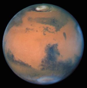
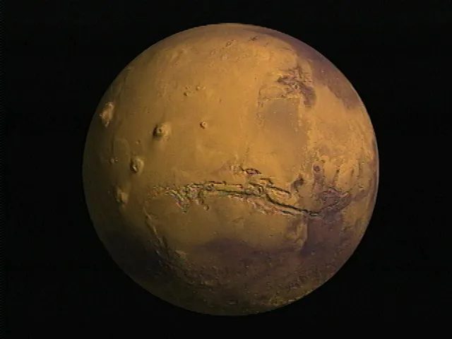
To observers on Earth, Mars looks like a rusty ball. The bright spots are ochre-red and black dots seem to float above them. Historically, astronomers called bright regions “deserts”. They named the great black spot “Maria,” the Latin word for sea or ocean. They really believed the water would cover them. This is not just a guess. This is a general theory. However, telescopes on Earth cannot see the terrain. They can only see changes in brightness. Or the opacity of the atmosphere changes. I can’t see the mountains. You can see the contrast.
Illusion of water and canal
The black mark covers about a third of the globe. They live mainly between 10 degrees and 40 degrees south latitude. Patterns are not static. It changes over decades and sometimes centuries. There are three main features in the northern hemisphere: the Acidalia plain, the Great Syrtis and the dark ring around the poles. Early explorers thought these were shallow oceans. Or maybe it’s a vegetated area. By now we know better.
Most of the dark areas are not water. It is sand blown by the wind. Or a bright, dust-free place. The wind stirs the black sand. They also clean the earth. A bright place? Most of the time it’s just a pile of dust. It’s a game of concealment and revelation.
Then there are the channels.
At the beginning of the 20th century, they were everywhere on the map. Renowned. detail. It is true to the people who drew it. The pictures of the spaceship do not show anything like that. The channel is imaginary. The observers widened their eyes. They pushed the resolution of telescopes to their absolute limits. The brain fills in the blanks. Connect the dots that don’t exist.
“These channels… are almost certainly imaginary features that observers thought they were seeing when exhaustively searching for objects near the limits of the telescope’s resolution.”
There were other phenomena that puzzled early astronomers. “Dark Tide”. “Blue Mist”. Both are tricks of the light. Observe changes in mixing conditions and surface reflectance. This is not magic. It is atmospheric optics and dusty surfaces that play games with human perception.
Polar
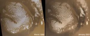
The Rhythmic Dance of Martian Ice
For those looking at the red planet through a telescope, the poles are where the action is. They follow a strict and predictable rhythm. When autumn arrives in a certain hemisphere, clouds begin to accumulate in the polar regions. The cap itself, made of frozen carbon dioxide, begins to expand.
It is asymmetrical. The polar cap stops growing at about 55 degrees latitude. The further south we went, the higher the temperature rose to 50 degrees. And then comes spring. The ice is receding.
Summer brings big changes in the north. The CO2 shield disappears completely. There are small remnants of water ice left. The south is different. Small remnants of ice remained there all summer, a tenacious mixture of carbon dioxide and water ice that refused to melt completely.
A Two-Century Mystery
It took nearly 200 years to figure out what these caps were actually made of. It started with William Herschel. A British astronomer observed Mars and hypothesized that its poles were similar to Earth’s. He thought it was water ice. It’s simple enough.
Then in 1898, Irish scientist George J. Stoney asked another question. He speculates that the cap might be frozen carbon dioxide. He had a hunch. But he has no proof.
In 1947, the evidence finally arrived. Dutch-American astronomer Gerard Kuiper discovered carbon dioxide in the atmosphere of Mars. This is the missing link. The hypothesis shifted.
Modeling the Cold
In 1966, the discussion shifted from speculation to exact figures. American scientists Robert Leighton and Bruce Murray created a numerical model of the thermal environment on Mars. Their results seriously questioned the water ice theory.
According to their calculations, under Martian conditions, atmospheric carbon dioxide freezes at the poles. When they modeled the growth and contraction of the carbon dioxide cap, the behavior matched what astronomers actually observed.
The model predicts certain information about the depth of these caps. It is very thin. It is only a few meters deep near the poles and gradually thins towards the equator. This is a simplification of the real situation, but it still applies.
It was confirmed two years later. In 1969, the Mariner 6 and 7 spacecraft flew by Mars. Their thermal and spectroscopic measurements were in perfect agreement with Leighton and Murray’s predictions. The caps were indeed carbon dioxide.
Transient atmospheric phenomena
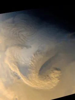
For the first time, telescope observers noticed that features on the surface of Mars sometimes disappear. These temporary disturbances appear as white or yellow spots. The researchers correctly identified the white spots as condensed gas and the yellow haze as dust. They also found that the black spots disappear from time to time, usually during the southern summer. Another correct explanation is that a global dust storms covered everything. The spacecraft later confirmed that fog, clouds, and fog often veil the surface.
Composition of Martian air
In 1947, the Dutch-American astronomer Gerard P. Kuiper used data from the telescope to determine that the composition of the Martian atmosphere was mainly carbon dioxide. The air is incredibly thin. It exerts less than 1 percent is less than 1% of the Earth’s atmospheric pressure. Due to the large differences in topography, the pressure areas vary by a factor of 15. Today, there is only small amounts of water in the air. When all the water settles, ice crystals form that are only 10 micrometers thick. They can be collected into solid blocks no larger than a medium-sized iceberg.
Despite the scarcity of water, the atmosphere is still close to saturation. Water ice clouds are often seen. Low-lying clouds and fog accumulate in depressions in the landscape, such as valleys and craters. Thin clouds often appear at the morning terminator, i.e. the border between light and dark. Orographic clouds form when moist air rises higher and cools. They form around visible features such as craters and volcanoes. Westerly moving spiral storm systems occur regularly in mid-latitudes during winter. Most clouds, including the white clouds seen by early observers, are composed of water ice.
When the dust flies
Sandstorms are a common feature of Mars. It can occur at any time, but peaks in the southern spring and summer. This period coincides with Mars’ closest approach to the Sun. The surface temperature reached its maximum temperature at that point. Most storms are regional. They last for several weeks. But every two or three years the storm goes global. Dust rises at the top, and only the tops of the tallest volcanoes are still visible. These mountains are located 21 kilometers (13 mi) above the planet’s mean radius.
The Martian atmosphere is more than just thin air. It is a dynamic system of pressure, ice and dust. Clouds form in predictable patterns. Storms follow the rhythm of the seasons. But without seeing global events first hand, it is difficult to grasp their scope. What happens when the dust covers everything? The surface becomes an empty slate. Observers on Earth have seen this happen. We’re looking at it now from orbit. The question is what happens next.
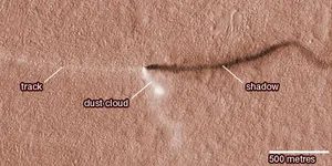
Mars Ghost Cyclone
It is not visible from Earth. Too small, too weak. But orbiting spacecraft and landing rovers have detected the activity. dust devils. The thin spiral marks seen in high-resolution images of Mars are the scars left by this invisible hand. they are very common. they are very tenacious. They give the planet a personality all its own.
The atmosphere feels different there. In the lower atmosphere, the temperature is about 200 Kelvin. It’s -100°F. -70℃. Colder than the average daytime surface temperature of 250 K (−10 °F) during the day. You walk through a world colder than your skin during the day. Looks like Antarctica in winter. Cruel. still. But change the seasons. Enter very dark ground in the summer. The sun was shining brightly. The daytime temperature can reach about 290 K (62 °F). A calm spring day on earth. On Mars, this is a rare treat.
Above the turbulent layer near the ground, the situation becomes unstable. The temperature decreases with increasing altitude. About 1.5 K per kilometer. 2.4K per mile. The higher you climb, the colder it gets. simple physics. harsh reality.
Why does the pressure on Mars change so quickly?
Earth’s atmosphere remains relatively stable. Mars is not like that. Air pressure varies greatly depending on the season. Why? Because the main gas is carbon dioxide. Carbon dioxide doesn’t just exist here. It freezes. It “snows out” at the winter pole. Then in the spring it goes straight back to gas. Sublimes. There is no liquid phase. It just turns a solid into a gas.
Southern winter caps are larger than northern winter caps. Therefore, when the south is dark, the pressure drops deeper. The atmosphere has reached its lowest point. Then it started again. This cycle repeats itself. The pressure changes by 26% per year.
Let’s think about this number. 26%.
Every year, about 7.9 trillion tons of carbon dioxide are released from the atmosphere and returned to the atmosphere. This is by no means a small amount. This corresponds to a layer of solid dry ice at least 23 cm (9 in) thick. Or meters of carbon dioxide snow. It is widespread. Air is sucked in and out. literally.
Chemical composition of thin air
What’s in the air? Carbon dioxide accounts for 95.3% of the weight. Nine times more than currently in Earth’s much larger atmosphere. But here’s the problem. Most of the Earth’s carbon dioxide is bound. Chemically bound to sedimentary rocks. The amount of carbon dioxide in the Martian atmosphere is less than 1000 times lower than the total amount of carbon dioxide on Earth. The rest is nitrogen. water vapor. Noble gas. argon gas. neon. krypton. xenon.
Martian atmospheric pressure experiences dramatic seasonal changes as carbon dioxide “snows” at the winter poles and turns directly back into a gas.
There are also small amounts of other gases. Molecular oxygen. carbon monoxide. Nitric oxide. Small amounts of ozone. These are not primitive relics. They are created by photochemical reactions. Usually located higher in the atmosphere. Sunlight breaks things down. Creates new things.
Composition of the Martian Atmosphere
| Gas | Wt% |
|---|---|
| Carbon dioxide (CO2) | 95.32 |
| Nitrogen molecule (N2) | 2.7 |
| Argon (Ar) | 1.6 |
| Molecular Oxygen (O2) | 0.13 |
| Carbon Monoxide (CO) | 0.07 |
| Water vapor (H2O) | 0.03 |
| Neon (Ne) | 0.00025 |
| Krypton (Kr) | 0.00003 |
| Xenon (Xe) | 0.000008 |
Source: Atmospheric Survey Data.
Lose the lightest element
The lower atmosphere supplies energy to the ionosphere. Low density. The temperature is very high. The components are separated by diffusion. Mass matters. Heavy things sink. Light objects float. At the top of the atmosphere, objects disappear into space. every time. This affects the isotopic composition of what remains.
Hydrogen is the lightest. It’s easy to escape. Preferentially. Deuterium is heavy. It stays. Due to the rapid loss of hydrogen, the Martian atmosphere has five times more deuterium than the Earth’s atmosphere. Chemical fingerprint. A record of loss. A reminder that the planet is shrinking. slowly. invisible. Into the void.
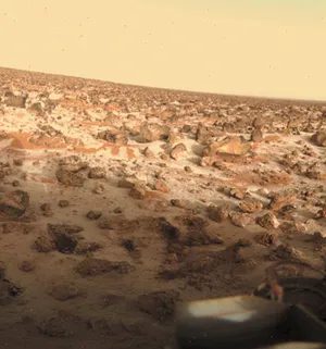
Water on Mars is a ghost. It’s there, but you can’t catch it. The Martian atmosphere contains only trace amounts of the element, just a few molecules per 10,000 air molecules. This deficiency is due to the brutal cold of the planet. Low atmospheric pressure and icy surface temperatures trap water in conditions rarely seen on Earth.
The Steam Paradox on the Red Planet
In fact, the atmosphere is saturated with water vapor. In a sense, that’s what it’s all about. But if you stand on the ground, you will see that there is no liquid water. If the temperature and pressure are too low, the liquid phase cannot exist stably. Water molecules on Mars can only exist as ice or steam. There is no middle ground. There are no puddles. No rain. It’s just a thin, cold mist.
Minimal Exchange with the Surface
Considering how cold the nights are, you might wonder if the frozen ground is constantly pumping moisture into the air. However, this situation is rare. Very little water exchanges with the Martian surface every day. Because the nights are so cold, atmospheric moisture is less likely to condense to the ground and stay there. It either remains suspended or quickly freezes on contact, creating a stalemate between the air and the soil.
This dynamic makes Mars a chemically active but physically dry place. Water controls atmospheric chemistry and meteorology and shapes weather patterns we barely understand. Although it does not touch the ground in liquid form, it circulates in the air and affects the movement of dust and the formation of clouds.
Why this matters to future explorers
Understanding this cycle of steam and ice is not just academic. It explains why frost forms on landing gear, why ice accumulates on solar panels, and why special techniques are needed to extracting water from the atmosphere. You can’t just dig for liquid aquifers. capture vapor or mine ice deposits must be recovered or the ice deposits must be mined.
The fact that liquid water does not exist doesn’t mean the planet is inert. This means that water behaves differently. It acts as a chemical catalyst rather than a solvent. It shapes the sky more than the soil.
This begs the question: If Mars is so dry, why do we see evidence of ancient rivers? The answer lies in a warmer, wetter and radically different past. The current state is a frozen relic from that era.
Scientists study these trace amounts to predict how planet’s climate will change during dust storms. Water vapor interacts with sunlight and dust particles in complex ways. It affects the temperature gradient in the upper atmosphere. It affects the formation of polar clouds.
The limits of Martian hydrology
The restrictions are strict. The pressure is too low. The temperature is too low. The water phase diagram on Mars leaves no room for stable liquids on the surface. This is a serious physical limitation.
Future missions must take this into account. They cannot rely on surface water sources. Systems must be designed to handle steam and ice. These small amounts of water cause chemical reactions in the air. It’s a delicate balance. The situation may change if the planet ever warmed significantly.
Currently, it is still a cycle of water vapor and ice. A silent, invisible engine that drives Martian weather. We are observing it from orbit. We measure it with a sensor. We try to understand a world where there is water, but there is none at all.
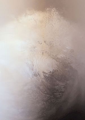
Hidden water cycle and ancient atmosphere
Water vapor is not only found on Mars. Mix evenly up to 10-15 km (6-9 miles). The distribution is not random. The strong latitudinal gradient is completely dependent on the season. The biggest changes are happening in the northern hemisphere.
When summer arrives in the northern hemisphere, the carbon dioxide cap of carbon dioxide disappears completely. What’s left is a water-ice cap. Sublimation begins. The water turns directly into a gas from the residual cap. This creates a dramatic concentration gradient. The vapor moves strongly from north to south.
The south tells a different story. In summer, carbon dioxide cap survives. Water ice is rarely observed. Therefore, strong atmospheric gradients usually do not form. The planet’s water cycle is asymmetrical. It hinges on seasonal caps.
Where is the ice hidden?
Water vapor in the atmosphere may come into contact with much larger reservoir. It’s in the soil. poleward of 40°, underground ice seems to be everywhere. Sublimation is prevented by the low temperatures underground. It’s trapped.
The Mars Odyssey probe confirmed this in 2001. At latitudes above 60 degrees, the ice is 1 meter from of the surface. It was found by the Phoenix lander at 68 degrees north latitude. We don’t know how deep it is.
Images from the Mars Reconnaissance Orbiter tell us even more. New impact craters between 40 degrees and 60 degrees north latitude, exposing subsurface water ice. It’s close to the surface 74 centimeters (29 inches). It’s close to the surface.
At low latitudes, the ice is unstable. The ice there sublimates into the atmosphere. The ground holds different secrets in the depths of the earth.
Where has the atmosphere gone?
Isotopic measurements provide clues. There used to be large amounts of carbon dioxide, nitrogen and argon. Mars may have lost much of its volatile store early in its history. The loss went into space or underground. Chemical locking in rocks.
The early solar system was harsh. The sun’s ultraviolet radiation was far more intense. The solar wind battered the planet. Mars once had a thicker atmosphere. Most of it drifted away. It was stripped by space.
The mystery and vertical structure of methane
Methane detected. Curiosity observed seasonal variation. Orbiter readings show random signs or are completely absent. This contradiction is important. Some processes remove methane near the surface before it spreads.
Volcanoes are ruled out. Meteorites are ruled out. This leaves a chemical reaction between rock and water. Or metabolism by possible of Martian microbes. The source remains a puzzle.
Vertical structures are based on energy transfer. Temperature and pressure are related to altitude. Solar energy enters. Radiation leaves. The balance is complicated.
There are two factors that control the lower atmosphere. It consists of almost pure carbon dioxide. A large amount of airborne dust. Carbon dioxide radiates energy efficiently at Martian temperatures. The atmosphere reacts quickly to changes in the sun. Dust directly absorbs heat from sunlight. It provides a distributed energy source.
The surface temperature varies greatly. Latitude is important. The change from day to night is very dramatic. At Viking 1 and Pathfinder locations (20°N), temperatures range from 189 K (−119 °F, −84 °C) before sunrise to 240 K (−28 °F, −33 °C) in the afternoon. The swing is larger than the deserts of the earth.
The changes are greatest near the ground. The thin, dry atmosphere causes rapid surface heat loss during the night. Dust storms impair this. The amplitude of the swing decreases. After a few kilometers, the diurnal variation decreases. Oscillations appear elsewhere. They are regular. Periodic. Synchronized with the Sun. Scientists call them tides. The atmosphere has a complex vertical structure.
Cooling proceeds upwards. The rate is 1.5 K per km. This continues for about 40 kilometers (25 miles). The tropopause is right there. The temperature is constant around 140 K (-210 °F, -130 °C). Scientists anticipated 5 K per km. The measured rate was unexpectedly low. The large amount of dust in the air accounts for the difference. The air is clearer than expected.
Beyond 100 kilometers (60 mi) the structure changes. Heavy molecules are concentrated under light molecules. Diffusion separation overcomes turbulence. Turbulence tries to mix everything together. At high altitudes, separation wins.
Ultraviolet light breaks down gases and ionizes them. Below is a complex chemical sequence. The average temperature at the top of the atmosphere is about 300 K (80 °F, 27 °C).
Why the weather on Mars cannot be compared to the weather on Earth
At first glance, Mars’ global circulation patterns are similar to Earth’s. The wind is flowing. Changes in the pressure system. Looks familiar. But if you look closely, the similarities disappear. The Martian weather system is fundamentally broken compared to our climate. We assume that since there is an ocean, the atmosphere behaves as expected. We don’t.
Mars lacks the thermal inertia that stabilizes Earth’s climate. Our ocean is like a giant cooler. Withstands temperature fluctuations. Mars has no such buffer. There, the atmosphere adapts to the solar input at an astonishing rate. When sunlight hits a certain area, the air reacts immediately. No delays. There is no storage space. It just gives you an immediate unpredictable reaction.
Consider the terrain. The altitude range of the red planet is enormous. There are deep basins and towering volcanoes nearby. This causes local pressure differences and blows in winds that do not occur on Earth’s relatively flat continental shelves. The terrain alone forces the air into complex and unpredictable paths.
Then there is dust. It’s not just a piece. It’s a heat engine. Suspended dust particles absorb solar radiation and re-radiate it, turning it into heat. This strong internal heating of the atmosphere completely changes the vertical temperature distribution. Wind speed changes. The place where the clouds form changes. On Earth, we monitor humidity. On Mars, we need to monitor the particle density.
The poles tell a different story. Most of the Martian atmosphere does not remain gaseous year-round. It freezes. Seasonal deposition in polar regions removes large amounts of carbon dioxide from the air column. Then, as summer approaches, it sublimates into the atmosphere. This creates a breathing planet. The total mass of the atmosphere varies by almost 30% between seasons.
This is not just an academic matter. Understanding this dynamic is key to future exploration. If you want to land an rover or design a habitat, you need to know if the air can withstand enough pressure to sustain life-sustaining systems. You need to know if the dust will cover your solar panel in a few hours. Martian weather is more than just a background event. This is a active, aggressive force.
Why do we keep comparing it to Earth? This is very comforting. This is wrong. The underlying reasons are different. All drivers are alien. The atmosphere is thin, dusty and unpredictable. It doesn’t care about our models. It cares about sunlight, rocks and ice.
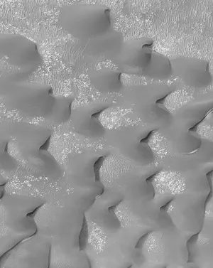
Wind Behavior at Landing Sites
Near-surface winds at the Viking and Pathfinder landing sites were usually regular in behavior and generally light. Average speeds were typically less than 2 meters per second (4.5 miles per hour), although gusts up to 40 meters per second (90 miles per hour) were recorded. Other observations, including streaks of windblown dust and patterns in dune fields and in the many varieties of clouds, have provided additional clues about surface winds.
Global Circulation Models and Seasonal Dependencies
Global circulation models, which incorporate all the factors understood to influence the behavior of the atmosphere, predict a strong dependence of winds on the Martian seasons because of the large horizontal temperature gradients associated with the edge of the polar caps in the fall and winter. Strong jet streams with eastward velocities above 100 meters per second (225 miles per hour) form at high latitudes in winter. Circulation is less dramatic in spring and fall, when light winds predominate everywhere. On Mars, unlike on Earth, there is also a relatively strong north-south circulation that transports the atmosphere to and from the winter and summer poles. The general circulation pattern is occasionally unstable and exhibits large-scale wave motions and instabilities: a regular series of rotating high- and low-pressure systems was clearly seen in the pressure and wind records at the Viking lander sites.
Localized Turbulence and Dust Dynamics
Smaller-scale motions and oscillations, driven both by the Sun and by surface topography, are ubiquitous. For example, at the Viking and Pathfinder landing sites, the winds change in direction and speed throughout the day in response to the position of the Sun and the local slope of the land.
Turbulence is an important factor in raising and maintaining the large quantity of dust found in the Martian atmosphere. Dust storms tend to begin at preferred locations in the southern hemisphere during the southern spring and summer. Activity is at first local and vigorous (for reasons yet to be understood), and large amounts of dust are thrown high into the atmosphere. If the amount of dust reaches a critical quantity, the storm rapidly intensifies, and dust is carried by high winds to all parts of the planet. In a few days the storm has obscured the entire surface, and visibility has been reduced to less than 5 percent of normal. The intensification process is evidently short-lived, as atmospheric clarity begins to return almost immediately, becoming normal typically in a few weeks.
Character of the surface
We already have a pretty good idea of what Mars is like. This is no longer a mystery. The spacecraft’s photographs and altitude measurements map the terrain in such detail that you can almost feel the grains of sand.
Almost the entire planet has been photographed from orbit. The standard resolution is 20 meters. It is 66 feet. It’s enough to see a big scar. the big canyons. The big volcanoes. But sometimes, we zoom in. The resolution of the selected area is up to 20 cm. It is 8 inches. You can see individual rocks. In some cases, tire tracks from spacecraft that have not yet landed can be seen.
A planet’s shape is just as important as its surface structure. Mars Global Surveyor’s laser altimeter does more than just take pictures. It measured height. Map the surface elevation of the entire planet.
Data averaged over a 300m diameter circle. It is 1000 feet wide. Vertical accuracy? 1 meter. 3.3 feet.
This Precision makes all the difference. Before that, we knew where things were. After that, we knew how high or low they were. You cannot understand the flow of an ancient river without knowing its slope. You can’t plan your landing zone without knowing the drop-offs. The map becomes three-dimensional. Real.
No more guessing the terrain. The numbers came in tight. In the desert, rocks are dangerous, so an error of a meter means great uncertainty. But 1 meter is manageable. This is reliable data.
The terrain features of Mars are no longer just visual. It’s measurable. And that changes how we move across it.
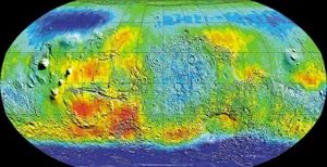
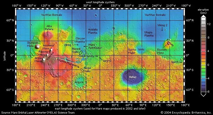
Network Definition: Where is the longitude of Mars?
If you’ve ever looked at a map of Mars, you might have noticed something odd. Some maps measure longitude east. The others headed west. This is not a malfunction. This is a historic baggage issue that started with Mariner 9.
After the first successful orbital arrival, scientists needed a baseline. They chose a smaller crater called Airy-0, which is located inside the larger Airy crater. This becomes the prime meridian. For a long time, the standard was to measure elevations in degrees west of this line around the globe.
But not everyone likes it. Some scientists have proposed a system where Longitude increases eastward. result? You can still view published maps on both systems. Choose your poison according to the map maker.
Extreme Altitude: Why Mars Has No “Sea Surface”.
Mars may look like a lifeless, dusty rock, but its terrain is harsh. It has more ups and downs than Earth.
The Earth is huge from the bottom of the Mariana Trench to the top of Mount Everest. About 20 kilometers (12.4 miles). Mars tops that. Its lowest point is in the Hellenic Impact Basin, 8 km (5 mi) below the reference level. The highest point is the 21 km (13 mi) high peak of Olympus Mons.
The total altitude range is 29 kilometers (18 mi).
“There is no sea on Mars, so the height reference level must be defined in terms other than sea level.”
How do you measure the height of a planet without water? In the early 1970s, researchers used basic pressure values. They set the reference height as atmospheric pressure, 6.1 millibars. This corresponds to about 0.006 of Earth’s sea level pressure.
Things were going well until Mars Global Surveyor arrived with very precise information. The old pressure indicators were too approximate. Scientists used a geometric criterion instead: the planet’s mean radius is 3,389.51 kilometers (2,106.14 miles). clean. Simple. Exact.
A large mountain range: northern lowlands and southern highlands
The most striking feature of Mars is not a single mountain range or valley. This is the dichotomy of the hemispheres. The planet is almost split in half down the middle.
The Southern Hemisphere is more like a pocket stamped wasteland at higher elevations. It’s like a desolate lunar plain. The terrain in the northern hemisphere is low and spars cratered. The average elevation difference between the two hemispheres is about 6 kilometers (3.7 mi).
Borders are not clean lines along the equator. Draw a large circle on it, tilted about 30 degrees. In some cases, it can be a large, irregular area. Other times it’s a steep cliff.
The Tharsis Rise runs along this boundary in the western hemisphere. This is a huge volcanic hill that is 4,000 kilometers (2,500 miles) wide. Its center is 8 kilometers (5 mi) above the reference level. This makes it 12 kilometers (7.5 mi) higher than the northern plains. Even compared to the Southern Highlands, it is more than 2 km (1.2 mi) higher than the surrounding terrain.
The planet’s largest volcanoes is located in this area. But here’s the thing that makes planetary geologists.
We do not find Earth-like plate tectonics on Mars. There are no long, straight mountains like the Andes. There are no grooves. There is no global system of interconnected ridges. This landform was formed by collisions and volcanic activity rather than plate movements.
Impact of Earth Division
How did this dichotomy come about? The leading theory is a catastrophic collision early in Mars’ history.
A massive asteroid slammed into the planet. The resulting impact crater covered the entire northern hemisphere. It is about 8,500 by 10,700 kilometers (5,300 by 6,600 miles) wide. The object itself would be over 2,000 kilometers (1,200 miles) in diameter. It is bigger than Pluto.
Gravity data from the Mars Global Surveyor supports this. This indicates that the Martian crust beneath the southern highlands is much thicker than beneath the northern plateau. The blows don’t just hit the surface. It fundamentally altered the planet’s structure.
Read Crater: Dating on the Southern Plateau
So how long has this desolate southern region existed?
The number of huge craters indicates its age. It is very old. Planetary researchers have a starting point from the Moon. With the help of the samples brought by the Apollo flights, it was possible to determine the age of the impact on the moon.
After the moon was formed 4.5 billion years ago, a large asteroid hit it very quickly. It rapidly declined between 3.8 and 3.5 billion years ago.
There are many pits on the surface that were formed before the recession. Surfaces formed later are less like that. Mars is likely to follow the same pattern.
Therefore, the history of the Southern Highlands almost certainly predates the recession. We are looking at a surface that has survived which is more than 3.5 billion years old.
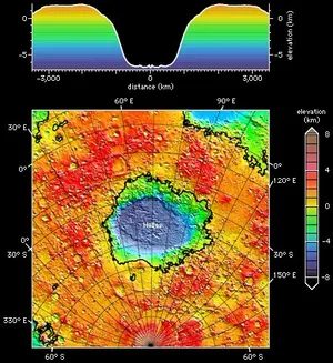
Craters tell the story of early Mars
Southern Mars is a scarred landscape. This terrain has a strange combination of impact characteristics. There is a massive basin. There are also large craters with low, flat floors. The rims were worn. You’ll also see smaller, fresher-looking bowls. They look like the surface of the moon. The rampart craters and pedestal craters add to the confusion.
Hellas is the standout. It is the largest impact basin on the planet. The width of this depression is about 7000 kilometers. The depth is 8 kilometers. A wide, raised ring surrounds the whole thing. It’s a huge scar on the Earth’s crust.
Erosion tells a different story. The tens or hundreds of kilometers wide craters are badly corroded. They are worn smooth. The small craters on the young plains appear untouched. Almost no erosion. The contrast is clear.
This comparison shows that early Mars had a much higher rate of erosion.
This is proof. This shows that the climate at that time was very different. Early Mars was not the cold, dry place we see today. It wears off quickly. Much of planet’s subsequent history was uneventful after that. The southern terrain remembers the storm.
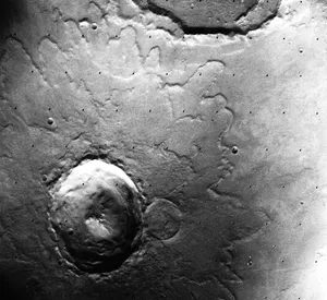
Why aren’t the craters on Mars the same as the craters on the Moon?
Look at the picture of the moon. You can see a sharp crater. Next, look at Mars. The crater there is soft. It looks like it has stains. This difference is no accident. It tells the story of what lies beneath the surface of the Red Planet.
A special type is the rampart crater. The name derives from the low ridges or ramparts that flank the ejecta salient. Ejecta is the material caused by an asteroid impact. On Mars, this material does not just scatter. It flows.
The ejecta apparently flowed across the ground, which may indicate that it had a mudlike consistency.
This flow indicates that something wet. The researchers suspect that the impact debris may have mixed with the groundwater. The result was mud. The impact didn’t just break rock. It turned it into a slurry. The sludge slid out across the surface. Those distinct, blobby lobes remain.
Then there is the pedestal crater. Here the ejecta forms a steep platform. The crater lies within its boundaries, like an island in a sea of dust. How did this happen? The ejecta acts as a protective shield. It protected the ground directly below from erosion.
The wind carved away the surrounding surface. It stripped the land. However, the material under the heavy ejecta remained intact. The wind can’t get there. landscape dropped away over time. protected area remained elevated.
These features are more than just aesthetically pleasing. They are clues. They suggest water once moved beneath Mars. These show how the wind shapes the dry world. They prove that impact events leaves a record in the environment. The surface remembers the mud The air remembers the stone.
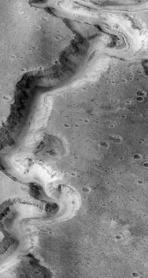
The ancient water network of Mars
The Viking spacecraft has taken a high-resolution look at southern Mars for the first time, and its findings are alarming. It is a honeycomb landscape with small valleys. It doesn’t look like a random crack. They look like drainage systems. Think of terrestrial rivers that dried up long ago.
Take the Nirgal Vallis for example. It is located in the southern hemisphere north of the massive Argyre impact basin. Next up is Nanedi Vallis. It is located close to the equator and hugging the eastern edge of Valles Marineris. These are not just scratches on the rocks. These are distinct, branching networks.
How did they get there? Scientists have debated this topic for decades. The most important theories can be summarized in two possibilities. First, direct runoff from rainfall. Rain hits the surface and carves channels. Another is the groundwater sapping. Water seeps from under the earth’s crust and erodes the rocks from below.
“In either case, their formation may have required warmer climatic conditions.”
Both scenarios call for a wetter, warmer Mars. A planet that may have liquid water on or near its surface.
Fresh valley at high latitude
Next up is the Mars Global Surveyor. This mission flipped the script. It found fresh-looking gullies. It is not an ancient eroded valley. Fresh. Looks very active. Found in high latitudes.
These gullies cling to steep slopes. They imitate the water-worn gullies of the Earth’s desert regions. An arid region where riverbeds dry up as a result of flash floods. The similarities are too strong to ignore.
Why are they there? Why at the poles and near them? The answer likely lies in ice. The ice melts and flows down the slope. But it’s not just ice. The ice is driven off the poles.
During periods of high tilt (when Mars is strongly tilted on its axis), the polar ice caps become unstable. The ice sublimates and moves. It is deposits itself at low latitudes. When the climate changes again, the ice melts. It can cause landslides. It cuts gullies in the terrain.
result? The landscape looks very young. Active. Even if the water doesn’t flow today. The scars remain.
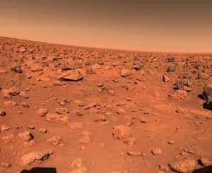
The scars left by asteroids tell the story of time. The southern highlands are dotted with bomb craters, evidence of an early violent history. The Northern Plains? Their scores are much lower. This rarity is no accident. This suggests that these plains formed at the end of a period of intense bombardment and stabilized between 3.8 and 3.5 billion years ago.
Mars is basically divided into two worlds. To the south is the Tharsis volcanic rise. And to the north is the vast, low-lying Northern Plains. These northern regions are surprisingly flat. They cover all areas within 30 degrees of the North Pole, except only the stratified terrain in the immediate vicinity of the glaciers. Three large blocks extend south to lower latitudes. Chryse Plain and Acidaria Plain are located about 30 degrees west longitude. Amazonis Planitia is located at 160 degrees west longitude. Utopia Plain is located at 250 degrees west longitude.
The only major irregularity in this endlessly flat space is the Utopia Basin. This is a large ancient impact scar located at 40 degrees north latitude and 250 degrees west longitude.
Buried history texture
A closer look at the northern plains reveals that the surface is anything but simple. Researchers have identified the unique topography of the area.
Let’s take “uneven ground” as an example. It is an isolated hilly area surrounded by flat land. These hills are not random. They are the remains of ancient porous surfaces. Something filled them. The younger material covers the older world, leaving only the highest peaks.
Other parts look like broken soil. A polygonal fracture pattern stretches across the surface. It looks exactly like permafrost on Earth. Next is the “fingerprint” texture. These ridges and grooves indicate that something strange is going on beneath the surface. Perhaps there was once stagnant ice that slowly melted and moved the land.
The big question remains: why did these plains become so low and flat?
Some geologists believe it to be lava. They found similarities with the moon Maria, which is a huge body of hardened basalt. Some offer separate accounts. They believe that this space was once occupied by the ocean. A great flood feeds it. The surface we see today may be the sediment left behind after the water disappeared.
What rocks tell us about climate change
We can’t just speculate about Mars’ past. The information on orbits and rovers gives a clearer picture. Old highlands and young plains are chemically different.
The Mars rover Spirit lands on a basalt plateau. These rocks are typical basalts. However, their skin is thin. These outer layers contain a lot of sulfur, chlorine and other volatile elements. These may have formed when the acid mist interacted with the rocks.
But Spirit moved on. It climbed into the Columbia Hills. All the stones there are different. They are still basalts and impact breccias, but they are usually altered. Contains plenty of sulfates and hydrated minerals. The soil itself can be almost pure sulfate or silica.
It’s not just the weather. These rocks have been permeated by warm volcanic fluids or weathered by warm surface conditions. This mixture of altered rocks and sulfate-rich soils appears to be typical of the highlands.
Orbital spectrometers confirmed this trend. Globally, plains consist of pristine minerals such as olivine and pyroxene. They haven’t changed much. However, ancient craters are full of altered minerals. Clay was everywhere.
Clay needs water. They need stability. The data show that surface conditions changed about 3.7 billion years ago. Before that date, it was warm and wet. Water changes rocks dramatically. After that date, those conditions vanished. Rock alteration became rare. The planet cooled. The water retreated.
Ancient river geometry
The ancient cratered terrain is divided by dry valleys. These are not random scratches. They form networks. Most are 1-2 km wide. Some are up to 2000 kilometers long.
They look like terrestrial river systems. Probably so. They were created by the slow erosion of flowing water.
Many local lowlands have special features. A valley enters. A valley leaves. This implies a closed basin. The lake could have been there for a long time. Beneath these areas are sediments dropped from still water. Delta regions are common because the valleys extend into the lowlands.
Such valley networks are rare in young, sparsely cratered regions. They are mainly limited to ancient terrain.
When we first discovered them in the 1970s, we were shocked. In today’s conditions, it would be difficult to prove the existence of liquid water at the surface. The pressure is too low. The temperature is too cold. Their presence in the heavily cratered north is undeniable proof. Early Mars was much warmer and wetter than today.
Outflow channel and ocean
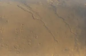
View high-resolution images from orbit. I see them cut through the ancient crust like the scars of a feverish dream. These are outflow channels and dwarf everything else on the Martian surface. We are talking about features tens of kilometers in diameter. They stretch for hundreds of kilometers. Most of them didn’t start small. They don’t meander over millions of years like a typical river. Fully formed, they burst out of the rubble-filled depression with almost no warning. They just show up.
Then they run down the hill. They ran across the northern plains. Some head straight south to the Hellas basin. Many of the major rivers flow directly into the Chryse Planitia from the southern and western highlands. That’s a massive basin. It is difficult to understand this relationship without imagining how deep and wide the trench needs water.
This is not just a riverbed. These are real channels. Once, they were completely filled with flowing water. Think about it. Most river valleys on Earth and Mars are like this, never approaching full water. They hold a small stream. But what about these Mars channels? They are pressurized pipes. The maximum flow blocked by floodwaters is estimated to be 100-1000 times the maximum flow of the Mississippi River. That is not a trickle. That is a cataclysm.
Where does the water come from? These theories have evolved over the decades. Some models point to a catastrophic leak from a huge underground lake. Imagine an ice sheet blocking a small lake the size of the earth and then disappearing. The release would be instantaneous and devastating. Other hypotheses point to explosive eruptions of groundwater. This means that the pressure will continue to rise until the crust cracks and water gushes out like a geyser on steroids.
Here is the kicker. These channels are newer than valley networks. They were formed when conditions were cold, dry and harsh, similar to what we see today. This is the part that keeps geologists up at night. Recent discoveries have revealed a very young outflow pathway. Not billions of years old. We are talking about the possibility of short-term formations. Could these large-scale features be formed today? The main idea is that groundwater rises from a kilometer below the permafrost. Ice acts as a cover. The pressure rises. The lid blows. Water flows out.
Valles Marineris
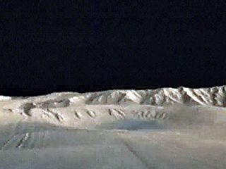
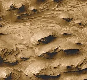
Tharsis Bulge and Elysium Planitia
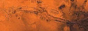
Valles Marineris did not appear out of nowhere. This is a scar caused by a large swelling in the Tharsis region. This is no small problem. On a planetary scale, this is the volcanic and crustal uplift that dominates the western hemisphere of Mars. The planet’s crust stretched under the weight of Tharsis. The tension bursts to the surface. The result is Valles Marineris. This is a scar caused by tectonic movement, not the scraping of a riverbed.
Where is Valles Marineris?
The canyon system is located near the equator. Its center is 70 degrees west longitude. Its length is about 4,000 kilometers. That’s 2,500 miles. This scale is hard to grasp because it dwarfs everything on Earth. The Grand Canyon is a toy next to it. Valles Marineris covers about 20% of the circumference of Mars. Its width is about the same as the continental United States.
How deep and wide is the system?
The canyon itself is huge. Each section is about 200 kilometers long. But the center is where the violence happens. Several canyons merged into the depression. This central Graben is 600 kilometers wide. Its depth is up to 9 kilometers. This is five times deeper than the Grand Canyon.
Were these canyons once full of water?
Geologists have found sedimentary layers rich in sulfate in the valley. Water is needed for sulfate formation. This suggests that there were once lakes in these deep trenches. If they did, they wouldn’t be able to keep calm. There is evidence that the drainage was catastrophic. Water likely burst eastward. It carved out the large outflow channels that begins at the eastern end of the system. The water did not drain out. It exploded.
Tharsis and Elysium: Volcano Engine
You can’t talk about Valles Marineris without mentioning Tharsis This region has the largest volcanoes in the solar system. The weight of these mountains pushed the crust downward and outward. The resulting stress fractures formed a canyon system. This is a planetary-scale failure.
Elysium is another large volcanic center. It is located in the northern hemisphere of Mars. Smaller than Tharsis, but still important. Valles Marineris separates the two areas. They act as a balance. Although the volcano’s eruptions are dormant, its volcanic activity continues to influence the planet’s surface to this day.
Why is formation important?
On Earth, the Grand Canyon is divided by the Colorado River. This is an erosional feature. Water and time helped. Valles Marineris is different. It consists mainly of faults. The crustal rock is due to tectonic movements. Later erosion widened the trench and made it deeper. The main reason is structural. Another reason is the weathering. This difference changes the way we interpret the geologic history of Mars. It tells about internal stresses, not just surface water.
How does this affect our search for life?
If lakes existed, sulfates remain. These minerals preserve organic molecules. They protect them from radiation. Valles Marineris is the main objective for future missions. Rovers need to drill into these sulfate sequences.
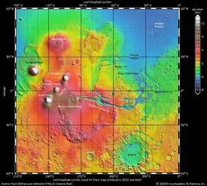
This is not the end of Valles Marineris. It hit Tharsis rise, a giant bulge that dominates the Martian landscape. This is not a subtle feature. The hill is more than 8,000 kilometers long and 8 kilometers high in the middle. It’s a geological heavyweight.
Near the top of this bulge three titans stood watching. Ascraeus Mons, Mount Arsia, and Mount Pavonis are located 18, 17, and 14 km above the mean radius, respectively. they are huge. The real king sits at the northwest tip of the rise. Olympus Mons. is 700 kilometers long and rises almost 22 kilometers above the surrounding plains.
Why Tharsis is important to the history of Mars
The scale here is hard to grasp unless you understand that it is not static. Tharsis is a large mass of volcanic rock. Most of them were formed 3.7 billion years ago, but were never truly settled. Volcanic activity has continued ever since. It is still the center of heat and movement.
Between these giants are small volcanoes and lava fields. They fill that gap. They tell the story of a planet accelerating upwards.
The spread of Alba Patera
To the north of the main cluster is another anomaly. Alba Patera holds the record for areal extent. Its width is 2000 kilometers. However, its height is only 7 kilometers. Instead of pointing up like needles, It spreads out like a pancake. This contrast in shape and size of Tharsis reveals different eruption styles over billions of years.
How these giants shaped Mars as it is today
The massive mass of Tharsis affects everything around it. The weight of these volcanoes may have changed the warped the crust. This may have triggered the formation of Valles Marineris itself. There’s a reason the canyon ends here. The ground beneath them was pushed up.
Scientists are not only studying the height of these mountains, but also what they reveal about the internal heat of Mars. Did the planet cool too quickly? Or is there still molten rock in the crust? The answer lies in the ashes and stones of these mountains.
Where to Look Next
When scanning images of Mars, focus on the Tharsis region. It is a graveyard of giants and a cradle of geological wonders. The lava fields in between show flow patterns. They mapped the movement of ancient magma.
The story does not end with formation. It still lives in cracks in the crust and in the dust that falls from them. Mars is still talking. All you have to do is listen to the silence between the peaks.
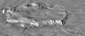
Traces of crustal deformation on Mars
The Martian crust doesn’t just sit there. It is stretched and narrowed. The Tharsis Bulge, a huge bump on the planet’s surface, produces enough pressure to crack the Earth. Traces of damage can be seen everywhere. Huge cracks radiate outward like the spokes of a wheel. The ridges are surrounded by compression ridges, which proves that the rock has been pushed down.
Such radial defects do not occur in isolation. It is believed to have helped establish the Valles Marineris system. This is a network of canyons that dwarfs the Grand Canyon. Movements of the earth’s crust caused by the rise of the volcano pulled the earth’s crust into place.
Next is Elysium.
It’s another volcanic eruption, but I’m shy about it. Located at about 215 degrees west longitude in the northern hemisphere, it is only a fraction of the size of Tharsis. The total length is only 2000 kilometers. It is only 6 kilometers high. Still, there are volcanoes. A quiet neighbor to the noisy area of Tharsis, but clearly part of the same volcanic history.
What’s under the poles?
Look at the telephone pole. Underneath the frost of the season lies something much older. Something thick.
Each Napa has a pile of fine-grained sediment. Its thickness is about 3 kilometers. Plenty of water ice. And they are surprisingly young, having only existed for tens of millions of years.
Stratification is not random. It is featured in a valley that winds out from the peripheries and poles. These layers tell the story of our climate. They recorded changes in the Earth’s tilt.
“On high slopes, water ice could be driven away from the poles, possibly completely destroying the remaining water ice covers and allowing ice to accumulate at lower latitudes.”
The more Mars tilts (higher inclination), the warmer the poles become. Water ice sublimates. It moved. It is stratified at low latitudes. Sometimes the hat disappears completely.
If the slope is small, the upper limit becomes the maximum value. The ice remains intact.
This cycle also suppresses dust. Changes in slope affect sandstorms. They change as dust collects on the poles. This is why the ratios of dust and ice are different in these layers.
These deposits are young because they have accumulated since the previous high gradient. Prior to this, previous deposits were removed.
There is something strange at the North Pole. Ice-rich deposits don’t just exist in a vacuum. They are surrounded by large sand dunes. There is a lot of gypsum in the sand dunes. One of the sulfate minerals.
Did the wind carry the plaster there? Or is there ice in it? Although the full mechanism is still controversial, the relationship is clear. The extent of Antarctica is less clear. It looks further from the pole than the North Pole, but the data is even more confusing.
Summer reveals layers. Carbon dioxide compression occurs in winter. This cycle repeats itself. Earth breathes in frost and breathes out ice.
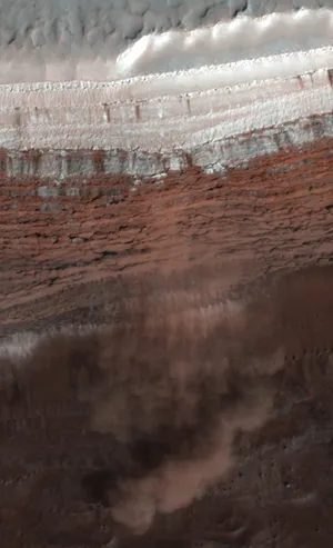
Where is there ice on Mars?
If you look for Mars at latitudes above 40 degrees, you will see a landscape where the ground ice is not moving. It is permanently stable. What is the secret? It’s depth. If it is less than a meter from the ground, the temperature will never rise enough to reach the freezing point. The ice is still there.
Above 60 degrees it is even easier. The ice is shallow and can be picked up by spacecraft from orbit. We found that to be true when the Phoenix lander landed at 68 degrees north latitude. Digging through the red earth, they found ice under the crust.
Craters reveals the truth
Recent impacts have done the digging for us in places. At these high latitudes, new craters have raised surface material to a depth of more than 2 meters. That is deep enough to reveal the ground ice on Mars.
The presence of this ice changes the look. You can see it on the polygonally fractured ground. It looks exactly like permafrost on Earth. The terrain is also softer. This is probably because the ice helps the flow of material near the surface.
There are certain clues in the 40-60 degree range. Look at the bottom of the steep slope. There is a Debris aprons. The material flowing from these slopes travels tens of kilometers away. Ground-penetrating radar confirmed the eye’s suspicions. These aprons contain large amounts of ice.
Ancient glaciers and high obliquity
The situation was different when the tilt of Mars was greater. During the high slope, the ice moved. It moved away from the poles and accumulated on the surface in lower latitudes. It probably formed glaciers.
Atmospheric circulation patterns indicate certain hidden locations. Western slope of Tharsis volcano. It is located in the northeastern part of the Hellas basin.
These places have abundant flow features. Their topography have moraine-like landforms. There is evidence that there have been glaciers there in the past.
The ice is still there. Waiting.

Surprises happen at the North Pole. There are the largest sand dunes on the entire planet. These dunes are located in the northern part of the Vastitas Borealis plain. They form a continuous strip that almost completely surrounds the remnant north polar cap. In places, the sand is covered with seasonal carbon dioxide snow. This shows that the dunes are active at least seasonally.
Internal structure
Seismic data from the InSight lander mapped the interior. Mars has three different layers. First, the crust. Its thickness varies between 24 and 72 kilometers. Below is the mantle. It is about 1,500 kilometers (930 miles) thick. It is also richer in iron than the Earth’s mantle.
What is deep inside is the core. It is an iron-nickel and molten. It has a radius of 1,830 kilometers (1,140 mi). The density varies from 5.7 to 6.3 grams per cubic centimeter. This high density means that the core contains more than 18% sulfur.
Isotope data from Martian meteorites confirms the planet differentiated. The metal-rich core and rocky mantle separated 4.5 billion years ago. This marks the end of planetary accretion. There is currently no detectable global magnetic field. This indicates that there is no convection inside the core. Convection requires heat-induced flow. However, the oldest terrains contain large areas of magnetized rock. This means that early Mars had a magnetic field. It disappeared as the core cooled and solidified.
Volcanic activity may occur today. It’s just a very low level. All Martian meteorites are volcanic rocks. Some are only hundreds of millions of years old. The remaining surface is sparsely cratered and is thought to be only tens of millions of years old. Mars has been volcanically very active in recent geological times. This means that the mantle remains warm. Local melting still occurs.
Gravity Anomalies
The gravitational field of Mars defies Earth’s patterns. The Earth has a balance between excess and deficiency of crustal mass. The peaks are replaced with depth compensation mass. The depth of the sea is balanced by the mass below it. This is an isostatic compensation. The force of gravity remains constant regardless of the height of the surface.
This balance also applies to the oldest terrains on Mars. Think of the Hellas basin and the southern highlands. Younger terrain tells a different story. The domes of Tharsis and Elysium are only partly compensated. They are related to the gravity highs. The gravity measured there is significantly higher. The huge mass of the dome causes spikes. There are similar areas on the moon called mascons.
The gravity of the southern highlands is equal to the gravity of the northern lowlands. This means that the southern highlands rest on a thicker crust. This material is less dense than the mantle below. Crustal thickness estimates vary widely. It is located only 3 km (2 mi) from the Isidis impact basin (north of the equator and east of Syrtis Major). It is located at the southern end of the Tharsis Rise and is over 90 km (60 mi) long.
Meteorite from Mars
Scientists have identified over 300 meteorites from Mars. Suspicion arose decades ago. These rocks appeared volcanic. Their age is about 1.3 billion years. All other meteorites are 4.5 billion years old. These rocks come from a body active in the recent past. Mars is the prime suspect.
These rocks have unique oxygen isotope ratios. They are very different from the earth, moon and other meteorites. Proof came later. Some meteorites have trapped gas. This composition is consistent with the Martian atmosphere measured by the Viking landers.
These stones were ejected by large impacts. They entered solar orbit. They spent millions of years there before falling to earth. In the mid-1990s, claims emerged. Scientists have found evidence of past microscopic life in a meteorite called ALH84001. The general scientific community is skeptical.
Martian Moons
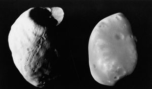
Sensitive satellites of Mars
Phobos and Deimos remained a mystery for a century. They were discovered in 1877 as dots on photographic plates. Nobody knows what it is. Then came the Viking landers. they changed everything.
Viking 1 was within 100 kilometers of Phobos. Viking 2 is even closer to Deimos, only 30 kilometers away. Get close enough to see the texture. It’s close enough that you can see it’s bumpy.
Phobos behaves differently from ordinary moons. It orbits Mars in just 7 hours and 39 minutes. It’s dangerous to get close. The average distance from the earth’s surface is only about 6000 kilometers. This is less than twice the radius of Earth.
The gravity here is unforgiving. If Phobos lacks internal strength, tidal forces will tear it apart. This is the limit of Roche’s activity. The moon has collapsed. The same forces slow its rotation.
Where are we going? Eventually it crashes into Mars. schedule? Less than 100 million years ago. That sounds very long. This is nothing in geological time.
With Deimos, the situation is the opposite. It’s on a wider road. Tidal forces push it down, not down. It’s trying to move off the ground.
Can you see it on the surface? perhaps. Probably not. It’s small, so it gets dark. Its proximity to Mars limits its field of view. Equatorial orbit means near the equator. You can’t see anything when you’re on the pole.
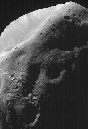
The broken surface of Phobos
Phobos, the larger of the two, is a tilted rock that appears pressed together in the dark. Its surface is messy. You can’t walk 5 feet without stepping on an impact crater. The largest of them is Stickney, whose scar was about half the width of the moon itself. It is so big that the shock wave could tore the crust apart.
Linear fissures cut across the terrain. They are not random. They radiated from Stickney like cracks in a windshield. This suggests that the impact did more than just create a hole. It destroys the structural integrity of the moon.
Why does Deimos look so smooth?
Deimos is small. It goes further. It looks nothing like Phobos.
The surface is smooth. Not without craters. Because the crater is full. Little pieces covered everything. There are no deep grooves. There are no obvious fractures.
The difference is due to gravity and distance. When Phobos is attacked, pieces will fall or it will flee completely. If it escapes Phobos, it won’t stay in orbit. It drifted and eventually landed on Mars. The moon removes the garbage.
Deimos keeps his songs in different ways. Smaller gravity wells would be too weak to push material into deep space, but it would be too far from Mars to capture it quickly. Debris remains in orbit. It will come back. It has been screened for a long time. It covers the surface. It hides the scars.
Original origin
The reflectivity of both satellites is terrible. they are very dark. Albedo is very low. This is consistent with the most primitive type of meteorite on Earth. A carbonaceous chondrite. There isn’t much warmth or separation.
This supports the main theory. So they are not unique to Mars. They are captured asteroids. Mars was still forming, but it was trapped inside a gravity well. The black surface is a remnant of its origin in the outer solar system.
Spaceship research
An early space race to Mars
Mars has fascinated humans since we first laid eyes on it, and not necessarily out of vague curiosity. There are three specific reasons that drive this obsession. First, it is the most Earth-like planet in the solar system. Second, it is the best candidate for indigenous life outside our world. Third, it can be the first destination that human boots reach.
In the 1960s-1980s, it wasn’t just science. This is the battlefield of the Cold War. The United States and the Soviet Union saw Mars as the ultimate testing ground and invested resources there.
Americans have their moments too. Mariner 4, Mariner 6 and Mariner 7 flew over and took pictures from a distance. Next are the heavy lifters. Mariner 9 orbits. Vikings 1 and 2 did two things: orbit and land.
The Vikings didn’t just look. They land and stay.
The Soviets were fighting back. Mars 2, 3 and 5 were the days they tried to answer that call. Two probes actually reached the surface. On December 2, 1971, Mars 3 made history. It was the first spacecraft to soft-land an instrument module to another world.
The landing was not pretty. It happened during a planet-wide dust storm. The lander returns about 20 seconds of data. Then silence.
However, the information returned is important. The launch of Mariner 9 in November 1971 changed everything. It is the first spacecraft to orbit another planet. It lasted until October 1972.
The camera roll tells a different story than we expected. Mariner 9 sent back 7,330 images. It covers 80% of the surface of Mars. The photo shows volcanic activity. These indicate ancient water erosion. These are indicative of internal forces that shape vast regions.
The planet wasn’t dead. It’s active, at least recently enough to leave deep scars on the geology.
Why sandstorms are important
Why was that 20 seconds on Mars 3 more important than failure? Because it proves that a soft landing is possible even in the worst conditions. American Viking forces later managed to land, but the Soviet Union showed them a way to weather the storm.
Data from Mariner 9 fills this gap. We know about craters. We didn’t know about the water. Spectral and radio propagation data support the photo. The surface is more than just stone. This is a record.
It’s not just about mapping. This is about finding the prerequisites for life. Or rather the remains of it. Volcanic activity explains the high temperatures. Erosion explains the presence of water. The reshaping explains this movement.
People don’t just watch anymore. We listen to the planet’s history.
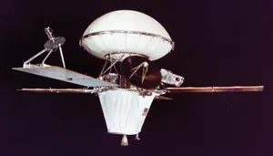
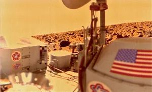
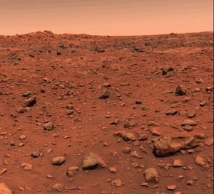
The Viking mission is driven by one main goal: the search for extraterrestrial life. What is the verdict? There is no conclusive evidence. Biology is still elusive, but science is rich.
Viking 1 and 2 aren’t just looking for microbes. They mapped the geology of Mars. They watch the weather. They analyze the physics and chemistry of the upper atmosphere. Two in orbit. There are two landing craft. Much work has been done to understand a planet that looks red but behave strangely.
Landing in the Red Dust
Timing is everything.
Viking 1 entered orbit in June 1976 and Viking 2 in August. Once in orbit, the landing module separates. They need a good landing spot. It’s not just dirt.
Viking 1 landed on July 20, 1976. Where? Chryse Planitia. Coordinates: 22 degrees north latitude, 48 degrees west longitude. Beautiful plains.
Viking 2 then landed. September 3, 1976. The situation continues. It is 6500 kilometers away. About 4000 miles. The location is Utopia Planitia. 48 degrees north latitude, 226 degrees west longitude.
There are two landing craft. Two completely different geological environments. And it has no biological activity.
“The instruments on both the orbiter and the two landers provided detailed information on Martian geology, meteorology, and the physics and chemistry of the upper atmosphere.”
Additional actions of the Soviet Union
5 years later. 1988.
The Soviets launched Phobos 1 and 2. The purpose is different. This is not a landing. Orbital observation. Slow flybys of Mars’ moons. Especially Phobos and Deimos.
It didn’t work.
Phobos 1 failed on its long journey. After a year long journey, it stopped. No data available. Nothing.
Phobos 2 was a success. It arrived at Mars in early 1989 and lasted several days. It sent back observations of the planet itself and its moon Phobos. Then something went wrong.
Dead in space. Another chapter closed. The search continues elsewhere. But several days of data added to the puzzle.
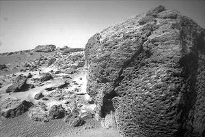
A turning point in the search for Mars
The late 1990s were the graveyard of NASA’s Red Planet goals. Several high-profile Mars missions have failed, giving the impression that exploration is too expensive. Then on July 4, 1997, everything changed.
Mars Pathfinder didn’t just survive. It landed on the vast northern plains of the Chryse Plain at the coordinates of 19 degrees north latitude and 33 degrees west longitude. We landed safely. But the real headline is not the lander itself. This is Sojourner, a small robotic probe on wheels that it deployed.
This is more than one step. This is a leap. For the first time, a mobile robot traveled to another planet. This shows that it can move beyond static stations. You can explore.
Draw an invisible map
While the Pathfinder worked on the ground, another ship waited in the dark. The Mars Global Surveyor arrived in September 1997. It took a while. It didn’t rush. The spacecraft enters orbit, preparing to rewrite our understanding of the planet from an altitude of 600 kilometers.
The investigation officially began in March 1999. What did we find? The answer can be found in more than just looks. they are physical. The spacecraft systematically mapped features that had long been a mystery.
- Gravity Field : Changes in mass beneath the crust reveal hidden structures.
- Magnetic Field : Remnant magnetism has a complex geological history.
- Terrain : Land shapes are drawn with new precision.
- Surface mineralogy : What are rocks made of? Research tells us.
High resolution eyes in the sky
The camera is the public face of the mission, but the scientific tool is the brain. The photographer can change mode. The wide-angle lens provides the background. Detailed images improve accuracy.
The resolution was staggering at the time. Down to 1.5 meters (5 feet).
It is small enough that you can see individual stones. Small enough to find rover tracks. When the Mars Global Surveyor took these pictures, it showed us more than just the red desert. It shows us a dynamic world. Each pixel is a data point. Every shadow has a clue.
The combination of orbital data and surface facts changes the game. Stop guessing. We started knowing. The accuracy of these two missions has eliminated the failures of the past decade. Pathfinder brought the rover. The Surveyor brought the map. Together they set the standard for everything that followed.
Still looking. Still mapping. Still trying to understand why the planet died.
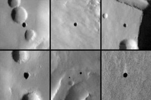
Mars Odyssey has proven its worth. In October 2001, the spacecraft successfully entered Mars orbit and was busy mapping out the planet’s secrets. It’s not just looking at the surface. Measure the chemical composition. Follow the distribution of ice near the surface. Analyze physical properties. The information is clear. Neutron measurements show large masses of groundwater ice above 60 degrees latitude.
The infrared camera found something completely different: a cave. A black round object appears as the entrance to the volcano. The temperature does not vary as it does in the surrounding terrain. Stability in this environment means protection.
Then came the convergence.
In late 2003 and early 2004, waves of spacecraft targeted Mars. The results were mixed. Japan’s Nozomi was the first to enter orbit in 1998, but broke down. It never entered orbit.
Mars Express follows closely behind. It was launched by the European Space Agency in mid-2003 and took six months to reach its destination. It is equipped with atmospheric, surface and underground equipment. It was launched into orbit on December 25.
But the lander failed.
The British Beagle 2 probe, tasked with probing rocks and soil for signs of life, touched down that day. Then silence. No radio signal. The study of past and present life on earth is over before it really begins.
However, the Orbiter continues to operate.
Mars Express discovered a large sheet of ice within weeks of its arrival. Water ice. carbon dioxide ice. Located at the south pole. It confirmed something subtle but important. In other words, the southern summer cap contains permanently frozen water, just like in the north.
The spacecraft also found sulfur-rich deposits. Mostly in Valles Marineris. Clay minerals appeared in heavily cratered terrains.
Why is this important? Because clay forms in water. Sulfur means chemical activity. Permafrost means that Earth’s water history is more than just a myth or a fleeting event.
The 2003 mission was not entirely successful. But they paint a more complex picture of Mars. It’s not just a dead stone. A place with layers. Includes hidden ice. There are also caves that provide shelter. Soil that once stored water.
The story of Mars exploration is not a straight road. It’s very messy. It is full of failures. However, the accumulation of data continues. The picture becomes clearer.
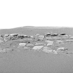
The Mars exploration schedule did not stop in 2003; It sped up.
A mid-year launch window will provide Mars rover missions. 2 rovers. planet. Two different stories.
Spirit hits the ground first. Gusev Crater, January 3, 2004. Coordinates are 15 degrees south latitude and 175 degrees east longitude. This is more than just a parking space. This is just a guess. Scientists chose this crater because orbital data suggest it once stored water.
Spirit wasn’t alone for long.
21 days later, Opportunity landed. Meridiani Planum. January 24, on the other side of the world. Latitude 2 degrees south, Longitude 6 degrees west.
These weren’t static landers. They were six-wheeled laboratories. camera. Microscopic imagers. Rock grinding tools scrape the surface of the rock to see what lies beneath.
The goal is simple. It’s all about finding water.
Both spacecraft found it. Or rather, they found a ghost.
The spirit confirmed the presence of minerals consumed by the water. But what about the possibilities? I thought it was instinctive. The rocks in the Meridian Plains look exactly like the rocks that formed around the lake. Or the sea. salt water. Ancient. Gone.
“Each spacecraft is designed for a nominal 90-day mission, but can continue to operate beyond that.”
Those words seem like a lie now.
This spirit continued until 2010. The opportunity continues until 2018.
Fourteen years. 45 km. Twenty-eight miles.
It’s not a rover. It’s a marathon runner from another planet. It set the record for distance and time on another world. And it didn’t just drive. It looked. It analyzed. This shows that Mars was not always a lifeless red rock. The weather is very rainy.
But rovers are slow. They’re ground-truth. You have to look from above to connect the dots.
In 2005. Mars Reconnaissance Orbiter (MRO).
This wasn’t a rover. This is a satellite with a lot of attention to detail. The High Resolution Imaging Science Experiment (HiRISE) can see up to 20 centimeters. 8 inches. That’s small enough to read a license plate from orbit.
MRO started mapping streaks.
There are dark stripes on the slopes. They appear in the spring. They disappeared in winter.
A spectrometer on board analyzes the composition of the surface. It found clay minerals. Alteration products. Forms only in warm and humid conditions. The ancient porous terrain is full of them. Mars has a warm past. A wet past.
Then there’s radar.
Underground radar. It didn’t just look at the surface. It looked inside.
Measuring the thickness of polar ice. Identify the glaciers buried under the regolith. Other places on the planet. Not just the poles.
So we asked the spacecraft to demonstrate the existence of water on Earth’s surface. Orbiters proving water exists underground. Clay minerals show that Mars was once warm enough to sustain its existence.
The story has changed.
Mars is not just a planet we visit. This is the planet we learn about.
Spirit and Opportunity are gone now. Silent
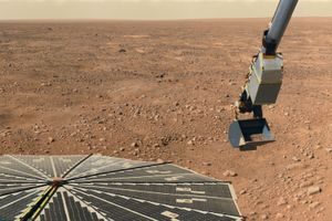
Mining of Martian ice and alkaline dust
The Phoenix lander landed in 2008. It’s not a great landing. An American spacecraft plunged directly into the north polar region of Mars and began its work. Its mission is simple. Explore the arctic soil.
For this purpose, Phoenix is equipped with a compact chemistry laboratory. This is not a large wheeled rover. This is a stationary laboratory designed for digging into the soil. The discovery changes our view of the history of Mars.
The soil below the Mars’s surface contains water ice.
This is not a small amount. It is thick ice and hidden under dust. This discovery confirms the presence of water on Mars today. It’s not just ancient lakes and frozen oceans billions of years ago. Real ice awaits in the cold north.
But soil chemistry tells an even stranger story.
Phoenix analyzed the dirt and found it to be alkaline. The pH is alkaline. This means that the soil is not acidic. It is similar to desert soil conditions on Earth. This is important. Acidic water can be irritating. Alkaline environments may be more suitable for potential microbial habitats.
“Phoenix didn’t just find water, it found a potentially habitable environment.”
The effect was immediate. If Mars has water ice and alkaline soil, it has the ingredients for life. We don’t know if there is life there. We don’t even know if it ever did. However, Phoenix proved that the environment is not hostile. This is neutral. Maybe even welcome.
This discovery changes the focus of Mars research.
Before Phoenix, researchers looked for ancient riverbeds and dry lakes. They are looking for evidence of water flowing in the past. Phoenix discovered modern water. We found soil that supports biology. This changed the search strategy.
It’s not just a matter of where the water is. It is “how” to preserve it and “what” the soil can do. The Arctic region is the primary target. It’s not just about getting ice. But it’s about understanding the planet’s chemical balance.
Alkaline soil also has a complicated history.
How does soil become alkaline? Could the volcanic activity have had an effect? Did atmospheric changes lasting millions of years change its chemical composition? Phoenix has not answered all of these questions. It provided the first clear data. Soil is more than dust. This is a record.
This information is important for future missions.
If humans are going to Mars, we need water. Phoenix showed it’s there. Clear. just below the surface. It also suggests that soil may be easier to work with than previously thought. Alkaline soil is less corrosive. Can be good for growing plants. Better suited to building structures. It continues to help sudirt life.
Phoenix didn’t last long. The battery died during the Martian winter. However, the findings lingered.
The Arctic is more than just a frozen wasteland. This is a resource. Chemistry laboratory. potential home. Phoenix showed that Mars is more than just a dead rock. It’s a place with active chemistry. The resources are there. With potential.
We still don’t know if there’s life out there.
But we know the stage is set. The water is there. The soil is ready. The question is not whether Mars can “support” life. The question is, whether life “ever” took that opportunity? Phoenix gave us the first
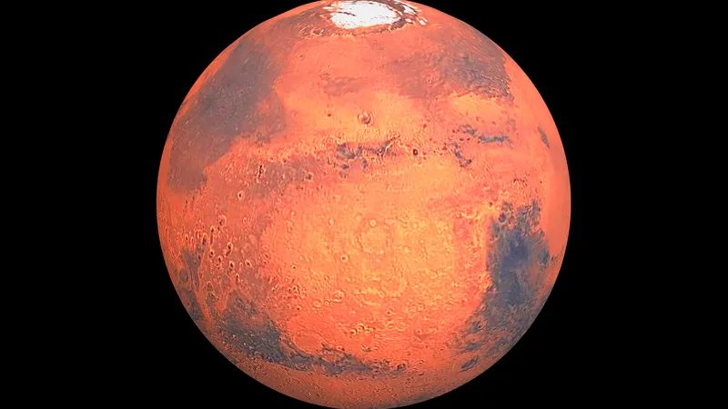
Problem solved: What Mars is really telling us
The story does not end with curiosity. The probe, a giant, 900-kilogram machine, showed that Gale Crater was once the bottom of a lake. Organic molecules have been found in 3.5 billion year old rocks. Methane has seasonal spikes. But to understand “why” Mars is dead today, we need to look higher. We must listen to the ground beneath our feet.
In September 2014, two spacecraft reached Mars orbit simultaneously. The stakes are different for everyone.
The US spacecraft MAVEN (Mars Atmosphere and Volatile Evolution) has one mission. It’s about figuring out where the atmosphere is going. The devices confirmed this cruel theory. The solar wind and ultraviolet light removed much of Mars’ early atmosphere. The planet didn’t just cool down Drained by the sun.
India’s Mars Orbiter Mission (MOM) also arrived at the same time. It was the country’s first shot at another planet. It is modest but functional: a color camera, an ultraviolet spectrometer and a methane sensor. This proves that it is possible to get to Mars without spending billions of dollars on landing systems.
Collapse and silence
The next chapter deals with Europe and Russia. The ExoMars mission was supposed to be a partnership. This is not true.
In October 2016, the Trace Gas Orbiter (TGO) and the Schiaparelli lander arrived. Schiaparelli ejected its parachute too early It hits the ground. No data available. Just a crater.
TGO, however, stayed up Map the vertical distribution of dust and water vapor. Next, look for methane. Nothing was found.
This creates conflicts. Curiosity detected methane. TGO saw nothing. The meaning is clear. Something destroys methane quickly. It doesn’t spread. It gets eaten or broken down before it can drift across the planet This remains one of the biggest questions in planetary science. How was it destroyed? who eats it?
Listening to the Planet
While the orbiters mapped the sky, the ground shook
In November 2018, the InSight lander landed on Elysium. This name refers to the exploration of the interior of the earth by seismic surveying, geodesy and heat transfer. A mouthful But the science is simple.
InSight introduced seismometers. For the first time, people heard vibrations from Mars. These data reveal the internal structure of the planet. It also found liquid water deep in the crust
Then there is the thermal sensor. To measure the heat flow, you need to dig 3-5 meters into the soil. But we didn’t get there. The spacecraft hit a hard object (possibly rock or gravel) and stopped. It hovered in the dirt, unfinished
However, InSight operated for four years. It made us really feel the pulse of Mars for the first time.
Small satellite, big idea
The same rocket shot carried something small. Two CubeSats.
The satellites named Mars Cube 1 (MarCO) were the first satellites to visit another planet. Each consists of six 10 cm cubes. It looks like an oversized Rubik’s Cube.
Their job was relay During InSight’s descent, the signal was not directly visible to Earth. MarCO-A and MarCO-B fly overhead and beam data back to us. This is proof of a small and affordable telecommunications network.
Ingenuity, the helicopter, came later Inside was a piece of fabric from the Wright brothers’ 1903 airplane. A piece of history on a rotor blade
Data is constantly coming. The silence of Mars is noisy.
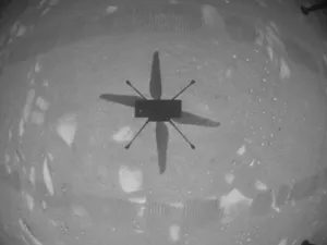
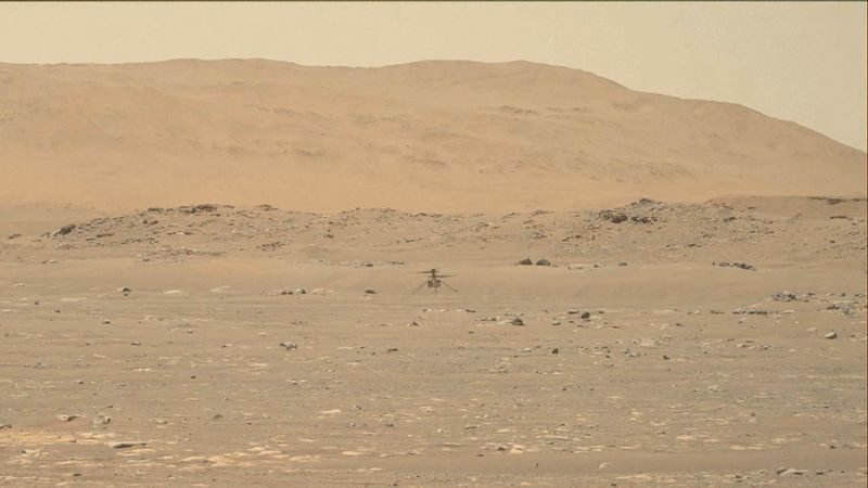
In February 2021, three missions arrived near Mars in a short time. This is no accident. This is the moment.
United Arab Emirates launches Hope Orbiter. It is equipped with a camera. This was followed by infrared and ultraviolet spectrometers. They scanned the Martian atmosphere for clues about its climate and weather patterns.
China has arrived at Tianwen 1. Consists of two parts. Orbiter. There is also an ATV called Zhurong. The rover landed on May 14. It’s small. Sovereign. It starts spinning on the surface.
Then there are the hard hitters. The US Mars 2020 flyby. Its main payload is the Perseverance cabin. Perseverance landed on February 18 and crashed into the Jezero crater. There was once a river estuary in this place. The weather is dry now. The goals are concrete. Looking for signs of ancient microbial life.
To do this, Perseverance conducted a training exercise. Core samples can be separated. The plan is to keep them. Finally, it is brought back to Earth for detailed analysis.
But grit goes beyond training. It is equipped with a helicopter. Original.
First flight to another planet
Originality changes the rules. It started on April 19, 2021. It reached 3 meters. 10 feet. It was the first plane to fly in the sky of another planet.
It just doesn’t float. It flew.
The task took longer than expected. Ingenuity completed 72 flights. This goes far beyond the first five flight tests. And it stopped in January 2024. One of the rotors was broken. The flight is over.
Future exercises and deeper research
Missions to Mars never end. A new car is already under development.
See ExoMars Mission Part 2. Includes the Rosalind Franklin Rover. It is expected to be released in the late 2020s. It brings new functions.
Rosalind Franklin’s education goes deeper. 2 meters. 6 feet underground.
Surface samples tell part of the story. They are exposed to radiation. Decomposition of organic molecules. Give these samples deeper protection. The rover will analyze them on board.
Why is this important now?
We’re not just poking the ground anymore. We’re going to bring back pieces of Mars. Persistence is caching. Upcoming quests will help you retrieve it.
Ingenuity proves that flight in empty air is possible. It opened the door to aerial reconnaissance. Future spacecraft may have wings. At least you can see better from above.
The question of whether there was ever life on Mars is still unresolved. But we ask better questions. Let’s dig deeper. We look higher.
The next decade will determine how close we get to finding out whether our Milky Way region is isolated. Or if we had shared this space long ago.
The ever-changing search for life on Mars
The question of life on Mars has been a cultural obsession since humans first pointed telescopes at the red planet. Early speculation focused on intelligent life. Today, the conversation has changed. We are no longer looking for little green men. We look for microbial communities. We try to understand where life begins and how far it continues.
The history of the search has been a rollercoaster of hope and despair.
In the 1960s, observers noticed changes on the surface of Mars. They wondered if biology drives these changes. This led to the development of Mariner 9 monitoring surface shifts in 1972 to monitor surface changes. This also led to the launch of the Viking landers launching in 1975. Complex experiments were carried out on these spacecraft. They hunted for metabolism. They are looking for organic molecules.
The result is negative.
This failure caused a wave of pessimism. For decades, scientists have lost faith in the possibility of life. In the 1980s, the prospects for Martian biology were quiet.
Then the perspective changed. There are several factors behind this optimism.
First, scientists understand that life is tougher than we think. Creatures have been found near deep sea vents. The temperature there exceeds 1000℃. They live deep in the basalt. They thrive in salty, acidic environments. If life can exist in such extreme conditions on Earth, why can’t it exist on Mars?
Second, the origin of life timeline on Earth changes the way we think. Life started very quickly. It probably appeared before the end of the heavy bombardment. This shows that life is not a rare coincidence. This is a possible outcome. If the conditions are right, life will follow.
Third, we now know that early Mars was different. When life appeared on Earth, Mars was in a similar situation to Earth. It was not the frozen desert we see today.
Fourth, rocks travel between planets. More than 30 pieces of Mars fell to Earth. They are difficult to distinguish from terrestrial rocks. Getting Earth rocks to Mars is even more difficult. However, during intense bombardments, it was possible to material exchange. Life could have started on Earth and moved to Mars. Or it started independently on Mars. We may never know for sure.
The meteorite controversy
In 1996, the scientific community was shocked. A research team has announced that they have found signs of life in a Martian meteorite. These claims are bold. They cite four specific pieces of evidence.
- Bacteria-like objects in electron microscope imagery.
- Hydrocarbon Detection.
- Mineral assemblages are not produced in chemical equilibrium.
- Magnetic particles are similar to particles produced by Earth’s bacteria.
The reaction is immediate. The validity of these claims is hotly debated in the scientific community. Is this proof? Or wishful thinking?
The consensus has since settled. All observations have a plausible non-biological explanation. These claims may not be true.
So where does that leave us?
There is still no evidence of life on Mars. But we have better tools. We know very well the limits of life. We know that this planet exchanged material with Earth in the distant past. The search continues. This is no longer speculation. It’s all about rigorous testing. The Red Planet keeps secrets. But the silence is broken.
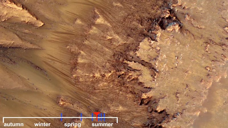
The search for life continues
The goal has not changed. We are still looking for life on Mars. Even after recent setbacks, the program remains focused on one goal. Water is an absolute requirement. Early missions therefore aim to look for evidence of warm conditions that may have kept water in a liquid state. We have strong evidence that this state existed in Mars’s distant past. Some data suggest that liquid water still flows on the surface from time to time in places.
But strategies change. We move beyond indirect clues to direct evidence. This means looking for organic remains. Or looking for certain isotopic signatures that only biology can produce.
One school of thought advocates digging into the past. We are looking for fossils from a time when Mars was similar to Earth. This makes sense. But there’s a problem. The debate about Martian meteorites shows how difficult it is to prove beyond doubt that something is biological. Disagreements about early life on Earth itself highlight this difficulty. Fossils can be ambiguous. They look like abiotic chemical reactions.
Another argument drives the current development. Discover the modern life. Look at the niches. Probably in a warm volcanic area. Or even in occasionally flowing salt water. The hope is simple. If there was life on Mars, it would probably survive where the conditions were still suitable. It didn’t immediately disappear everywhere. It withdrew.
Human exploration
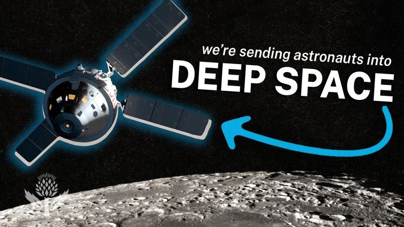
Long Way to Mars: Why haven’t we gone yet?
Human exploration of Mars feels like a mirage. We keep seeing it on the horizon, but it never fully materializes. When the Apollo program ended in the early 1970s, there was general optimism. It is believed that it is only a matter of time before Mars follows the Moon. This is not true.
Decades later, we’re still waiting.
The engineering challenges of getting humans to Mars and back are daunting. However, they are not unstoppable. We know how to build rockets. We know how to navigate. The real bottleneck is not physics. It is justification.
There is no practical reason that pays for itself in the short term.
Proponents argue that research is its own reward. Research is humanity. This is a noble feeling. It doesn’t help the budget. Some pointed to economic stimulus measures. They cite scientific discoveries and technical feedback. The benefits are real. But despite the noise, human missions to Mars are now further than they were in the 1970s.
Simulating the Void
We have been trying to solve this problem for years. Several studies have developed possible implementation strategies. Comprehensive simulations on Earth already provide data.
Consider the Mars500. This is a joint project of the European Space Agency and the Russian Institute of Biomedical Problems. From June 2010 to November 2011, six “astronauts” lived in isolation. They simulated a 520-day trip to Mars.
The conditions are very strict. Participants can only communicate with the outside world by voice. Communication was also delayed by 20 minutes. This mimics the radio delay between Earth and Mars. The possibility of live support has been eliminated.
NASA recently released its own series of simulations. From 2023, the agency launched CHAPEA. This is a research simulation of crew health and performance. Four astronauts spend a simulated year on the surface of Mars. These tests reveal how people react to captivity. They emphasized the psychological burden of isolation.
Two ways
Orbital mechanics dictate two basic classes of missions. The choice between them defines the entire mission profile.
Opposition-class missions are faster. The round-trip travel time is 500-600 days. Astronauts can stay on the surface of Mars for only 30 days. It seems efficient. Most studies conclude that speed is not worth the cost and effort. You get there fast, but you leave quickly.
Conjunction-class missions are slower. The round trip takes about 900 days. Astronauts can stay on Mars for up to 550 days. This requires more resources. More fuel is needed. The crew is exposed to cosmic radiation for a long time. Collaborative level tasks are usually prioritized, even though the resource requirements are higher. The longer the stay, the greater the scientific value. It justifies the risk.
Build a base camp
There are many variations on how to complete cooperative level tasks. One scenario involves sending a cargo ship ahead of time. This ship establishes a robotically operated base. Humans follow years later.
In other versions, all resources are accompanied by a crew. They leave Earth with everything they need to survive.
A critical issue is in situ resource utilization. Could we use resources already on Mars?
In situ resource units (ISRUs) can be deployed in advance. These units would extract oxygen from the Martian atmosphere. They would extract hydrogen from water ice. Power could come from solar panels or nuclear sources. As a result, oxidizer and propellant are stored for use on the return trip.
Man will not leave Earth until these resources have accumulated on Mars. This strategy saves fuel. It reduces the payload that must be launched from Earth.
Aerobraking offers another efficiency gain. The Martian atmosphere can slow down a departing spacecraft. The atmosphere at Earth can decelerate the incoming one. This enables significant savings in propellants. An additional option is direct entry.
What exactly do astronauts do there?
They can stay close to their base. They could operate remote robots at various locations. This minimizes the risk. Or they could go on extended trips. They can explore the planet directly. This incurs the risk of being stranded. There are no easy answers.
Human body under stress
Engineering analysis struggles with crew health. Prolonged stay in space can cause physiological damage.
The circulatory system is damaged. The vestibular system, which controls balance, is affected. Bones tend to demineralize. Muscle atrophy occurs.
Measures must be taken to minimize deterioration. Exercise regimens are standard. But can you prevent long-term damage two to three years after delivery?
Psychological stress is equally important. Hundreds of days in a closed space. There are no other companies. It is far from Earth. This will cost.
Radiation is a silent threat. Solar storms can occur during a 2-3 year journey. The crew is exposed to high levels of ionizing radiation. The protection system must be strong.
Protection of the planet
Pollution must also be taken into account. This is a scientific and safety issue.
The first concern is forward contamination. Mars must not be contaminated by materials from Earth. This must happen before the potential of Aboriginal life can be assessed. Robotic spacecraft have strict cleaning requirements. The touched surfaces are disinfected. This minimizes interference with the detection of extraterrestrial life.
Human tasks cannot follow these strict protocols. we are too big There are too many of us. We remove skin cells. We exhale carbon dioxide. We brought germs with us.
Another is backflow contamination. What would happen if there was life on Mars?
International agreements require that material brought from Mars be quarantined. They must be safe. Astronauts may also be quarantined.
Fortunately, most planetary protection problems are solvable. Robotic return of Mars samples will likely occur before the arrival of a manned mission. You can test the sample. We can prove safety. Then send the people out.
The path is clear. The technology exists. The data was obtained by simulation. The reason for this is debatable. The delay is not due to impossibility. This is optional.